May 23-24 and July 18-19, 2001
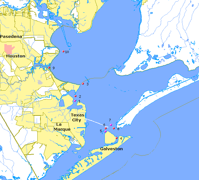
| Date | Name | Site | Latitude (N) | Longitude (W) | Total Flow | Water Quality | Velocities | Photos |
|---|---|---|---|---|---|---|---|---|
| May 23-24 | Galveston Channel | 4 | 29° 19.8' | 94° 46.8' | T G | T G S | T | NA |
| GIWW at Pelican Island | 5 | 29° 21.0' | 94° 49.2' | T G | T G S | T | NA | |
| Texas City Ship Channel | 6 | 29° 21.6' | 94° 48.6' | T G | T G S | T | NA | |
| Houston Ship Channel Near Texas City Dike | 7 | 29° 22.2' | 94° 48.0' | T G | T G S | T | P | |
| Bolivar Roads | 8 | 29° 21.6' | 94° 47.4' | T G | T G S | T | NA | |
| July 18-19 | Moses Lake | 1 | 29° 27.0' | 94° 55.2' | T NA | T G | T | P |
| Dickinson Bay | 2 | 29° 27.6' | 94° 55.2' | T G | T G | T | P | |
| Eagle Point to Spoil | 3 | 29° 30.0' | 94° 54.0' | T G | T G | T | P | |
| Clear Lake | 9 | 29° 33.0' | 95° 01.2' | T G | T G | T | NA | |
| Red Bluff to Spoil Island | 10 | 29° 36.0' | 94° 58.2' | T G | T G | T | P |
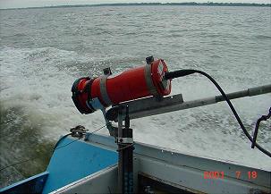
The Acoustic Doppler Current Profiler (ADCP)
For more information, please contact:
Dr. Carla Guthrie, Aquatic Ecologist
Email: Carla.Guthrie@twdb.texas.gov
Surface Water Resources
FAX: (512) 936-0816